The industrial revolution brought about a drastic change as we began to rely on fossil fuels as our main source of energy, particularly coal and oil. These sources of energy release large quantities of pollution into the atmosphere such as Carbon Dioxide, Methane, or Nitrous Oxide through their extraction and use which then trap heat from solar rays. This greenhouse effect is slowly warming the planet as we produce CO2 and CH4 faster than it can naturally dissipate in the atmosphere. One consequence of this rising temperature is the melting of the ice sheets. Currently there are two major Ice Sheets on our planet left from the last glacial period; they are the Antarctic ice sheet and the Greenland Ice Sheet. These two ice sheets hold about 99% of the earth's freshwater, and if they were to melt the Greenland Ice Sheet would raise the sea level by roughly 20’ while the Antarctic Ice Sheet would raise the sea level by roughly 200’. As the ocean warms and the salinity content decreases from the ice melt, its volume increases through the steric changes. The term steric refers to when the volume of water increases due to its reduced salinity and warmer temperatures. Below is a chart from a report by the Virginia Institute of Marine Science illustrating the most important factors that will impact sea rise levels for Boston.

Scientists from the National Oceanic and Atmospheric Association (NOAA) completed a study which came to the conclusion with high confidence that the mean global sea level will rise by at least 8" but not more than 6'-6" by the year 2100. The Virginia Institute of Marine Science analysed the rise rate and acceleration of sea level rise from 1969-2017, this data was then used to created the projection that by the year 2050 Boston will experience a 1'-6" rise in Sea Level.

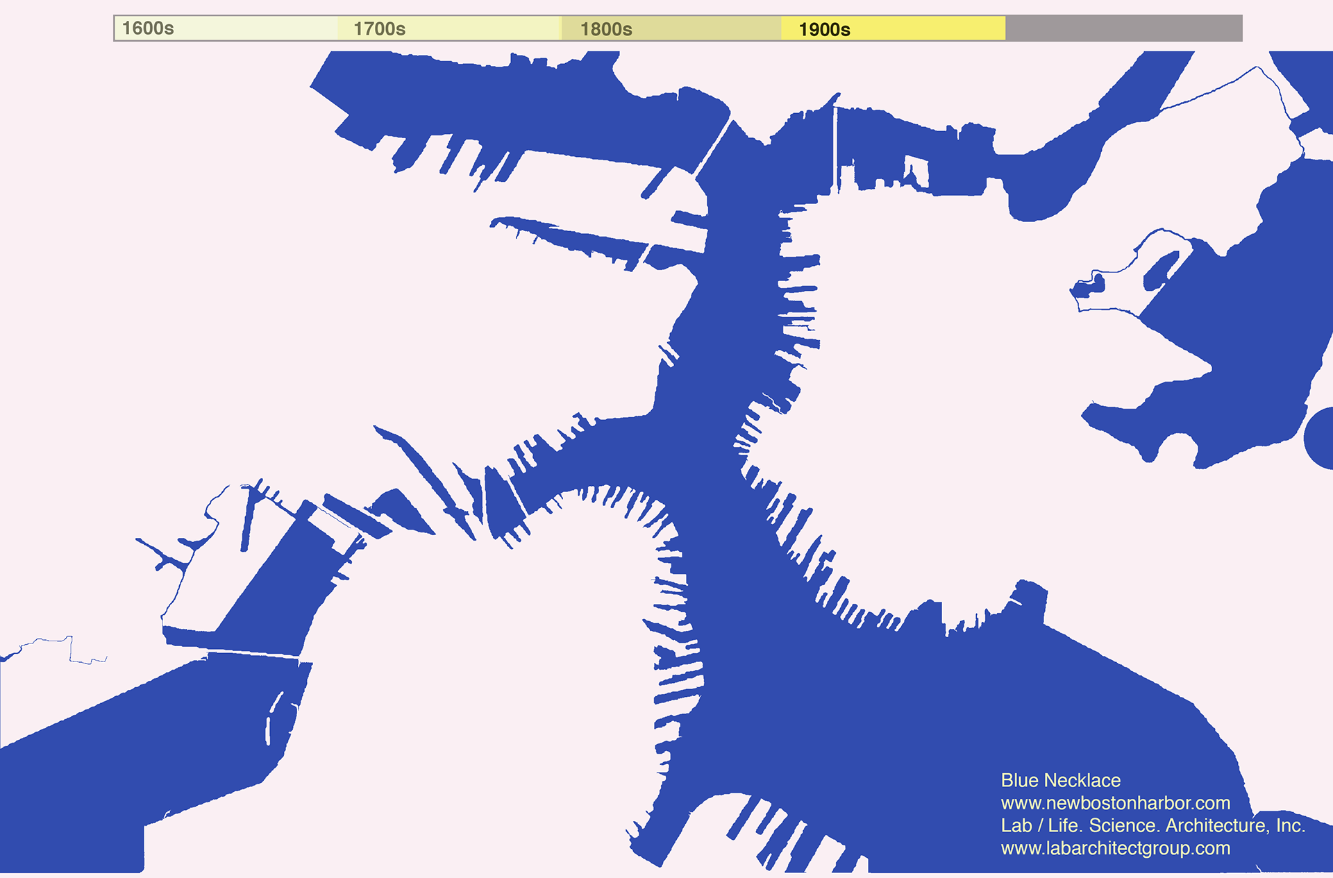
As Nancy Seasholes has compiled in the book, "Gaining Ground," and Alex Krieger has demonstrated in "Mapping Boston", Boston's history of urban growth has been hydrophilic, continually making new land from rivers, marshes, and the sea. Over 5,000 acres of made land extending from the original peninsulas of 1600s Boston comprise our current map. The primary reasons for land-making were to address military, transportation or environmental needs. Land-making for real estate reasons was often a secondary driver. In the 1700s, Boston first ventured into the water with the Barricado project, which was an attempt to privately fund and construct a defensive wharf for cannons. Private entities that participated were rewarded with land-making rights. Additionally, the creation of Long Wharf increased Boston's ability to accommodate deep water vessels more efficiently. In the 1800s, environmental concerns drove the filling of Mill Pond to create the Bullfinch Triangle. The North End and Waterfront was transformed from its original shoreline into a highly articulated network of new wharves, increasing Boston's capacity as a major sea port. Towards the later half of the century, the Back Bay was filled in primarily as an environmental response to remediate a stagnant, sewage filled marsh. Railroads requiring large yards and terminals were another significant cause of land-making in the last half of the 1800s, spanning into the 1900s. This was particularly apparent in Charlestown and the Fan Pier area of the Seaport. In the 1900s, the transformation of the map was most impacted by the development of Logan Airport in East Boston. Relatively little land-making has occurred in the 21st century to date, with the exception of the expansion and reshaping of Spectacle Island that was generated by the Big Dig. The Blue Necklace carries on the tradition of land-making in Boston as it aims to protect the city from rising sea levels.
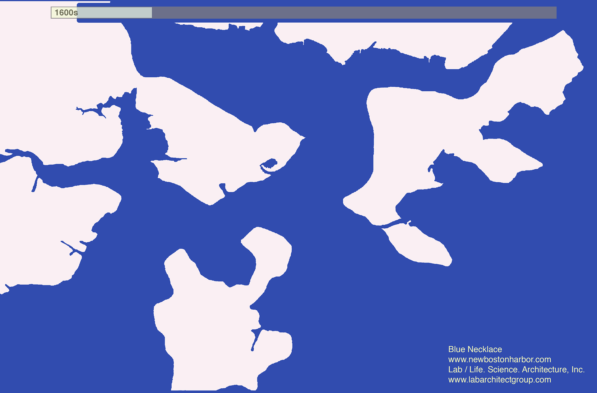
1600's
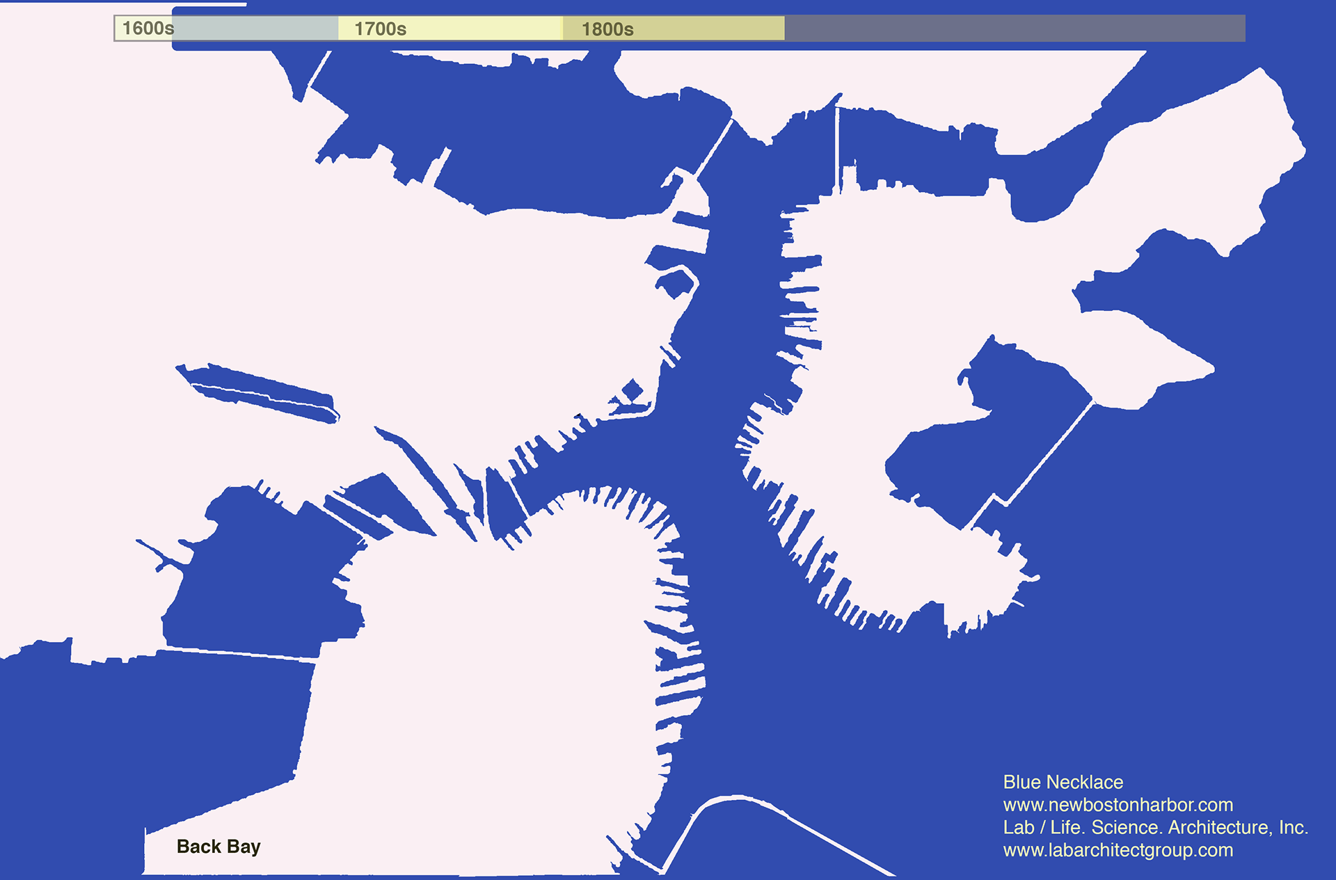
1800's